
Archive Record
Images
Metadata
Object Name |
Map |
Caption |
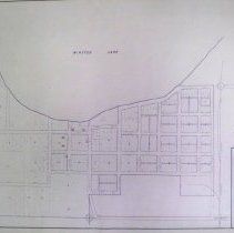
Winsted, MN |
Scope & Content |
Map of Winsted, MN created by M.W.P.A. Project 5259, c.1935-1943. Shows blocks, lots, streets, Minnesota Western Railroad tracks, location of public buildings, section corners, & Winsted Lake. |
Catalog Number |
2011-0229-006 |
Search Terms |
Winsted, Minnesota maps Minnesota Western Railway Maps Winsted Lake |
Subjects |
Maps Towns Roads Plats Streets Railroad tracks |