
Archive Record
Images

Metadata
Object Name |
Map |
Caption |
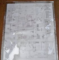
Winsted, Minnesota 1923 fire |
Scope & Content |
Copy of the December 1923 map of Winsted, McLeod County, Minnesota. Surveyed by General Inspection Bureau, Walter I. Fisher, Mgr. Map was used for insurance purposes. Population: 500; Prevailing winds: NW. Fire protection, waterworks and fire department equipment & alarm are described. Buildings are named, street addresses are marked, windows and number of stories are indicated, & stucco is noted. Map key. The original map is at City Hall, Winsted, and is a color photograph that Lois Chaddick from New York City provided. |
Catalog Number |
2010-0070-001 |
Search Terms |
Winsted, Minnesota maps Winsted, Minnesota fire department Winsted, Minnesota businesses Maps |
Subjects |
Maps Fire insurance maps |